Preparing land for new construction in Johns Island is the process of transforming raw, undeveloped property into a stable, compliant, and build-ready site through surveying, clearing, soil testing, grading, and excavation. Johns Island presents specific challenges that set it apart from inland South Carolina sites: the area’s low-lying terrain, high water table, and mix of sandy and clay-heavy soils demand a tailored approach at every stage. Skipping or rushing any step in this process puts your foundation at risk and can trigger costly delays. Licensed surveyors, geotechnical engineers, and experienced land clearing contractors are the three professional categories you need engaged before a single tree comes down.
What are the essential steps for preparing land for new construction in Johns Island?
Site preparation, the industry term for this full process, follows a defined sequence. Each step depends on the one before it, so the order matters as much as the execution.
-
Commission a licensed survey. A licensed surveyor produces topographic maps that establish site boundaries and elevation, identify natural drainage patterns, and flag any encroachments. This document becomes the foundation for every decision that follows.
-
Order a geotechnical report. A geotechnical engineer drills test borings, classifies the soil, and measures bearing capacity. On Johns Island, this step is non-negotiable. Soil variability on Johns Island means standard preparation methods can be insufficient without this data.
-
Secure permits and environmental consents. Failing to obtain permits can delay or derail your construction start date entirely. Charleston County requires excavation permits, and properties near wetlands or tidal areas need additional environmental review under South Carolina DHEC regulations.
-
Execute land clearing. Remove all trees, shrubs, stumps, and root systems from the building footprint. Leaving organic material under a foundation causes settlement and structural failure over time. The clearing method you choose affects both cost and soil health.
-
Grade and shape the site. Cut and fill grading levels the building pad and creates the slopes needed for stormwater control. This step also includes digging swales and establishing the rough drainage network.
-
Excavate for footings and utilities. Trenches are dug to specified depths for footings, utility lines, and drainage systems. Precision here directly affects foundation integrity.
-
Compact and test the subgrade. Soil is compacted in layers using vibrating plate compactors, and density gauges verify that each layer meets the engineer’s specification before the next is added.
-
Pass pre-pour inspection. Engineers and building inspectors verify formation levels, trench dimensions, and compaction results. Written sign-off is required before any concrete is poured.
Pro Tip: Monitor soil moisture levels throughout compaction. Johns Island’s humidity and frequent rain events can saturate subgrade soils quickly, and compacting wet soil produces a false density reading that fails under load.
How does soil testing influence construction site preparation and foundation planning?
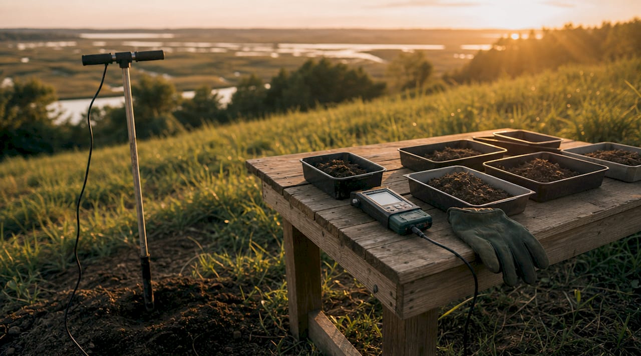
Soil testing is the most important variable in excavation planning because it determines which stabilization methods will prevent foundation failure. On Johns Island, two soil conditions appear most often: loose sandy fill near former agricultural land and expansive clay in areas with higher organic content. Both require different engineering responses.
The core tests a geotechnical engineer runs on a Johns Island site include:
- Bearing capacity tests to determine how much load the soil can support per square foot
- Moisture content analysis to identify saturation risk and compaction feasibility
- Soil classification using the Unified Soil Classification System to categorize material type
- Contamination screening on sites with prior industrial or agricultural use
Geotechnical assessments allow engineers to design tailored solutions like engineered fill or lime treatment based on actual local soil composition, rather than applying a one-size-fits-all specification that may fail under Johns Island’s specific conditions.
Clay soils expand when wet and contract when dry, creating cyclical movement that cracks slabs and shifts footings. Sandy soils drain well but compress unevenly under load. When geotechnical data guides stabilization, engineers can specify lime treatment to stabilize clay, engineered fill to replace poor native soil, or deep pilings where bearing capacity is simply too low for a conventional slab. Commissioning this report early in the project controls costs. Discovering a soil problem after excavation begins adds expense and time that early testing would have avoided.
Comparing land clearing methods suitable for Johns Island construction sites
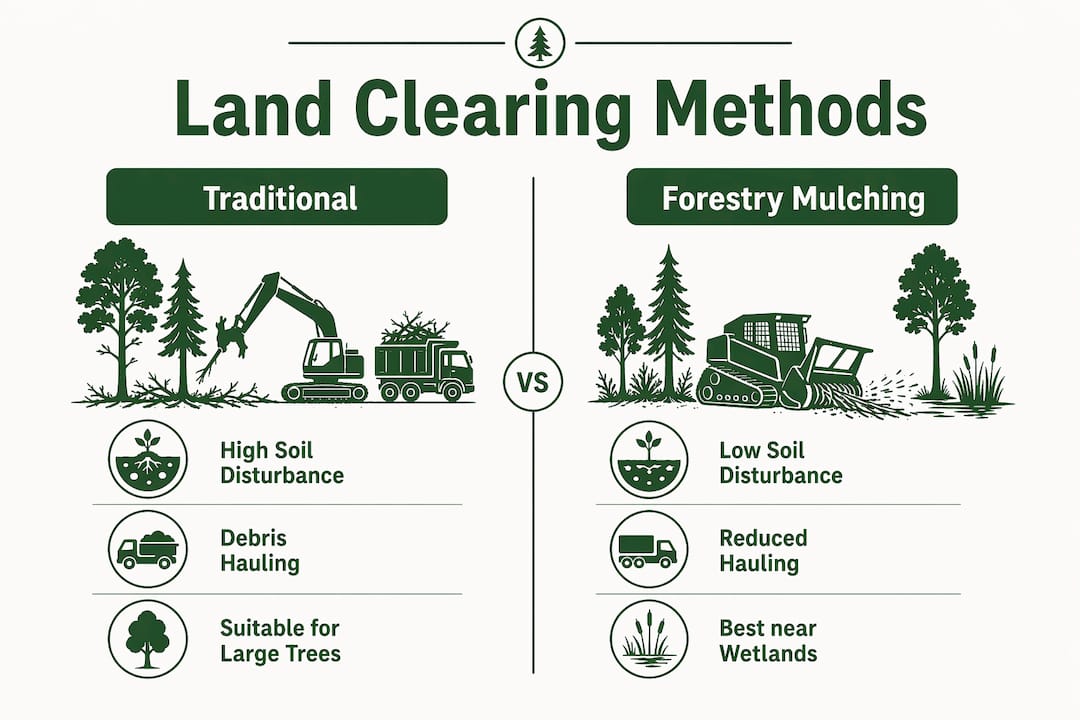
Two primary methods are used for construction site clearing on Johns Island: traditional clearing and forestry mulching. Each has distinct trade-offs in cost, environmental impact, and suitability depending on your site’s vegetation density and soil sensitivity.
| Factor | Traditional clearing | Forestry mulching |
|---|---|---|
| Soil disturbance | High: heavy equipment strips topsoil | Low: mulch layer protects soil surface |
| Debris handling | Hauling required, adds cost | Mulch stays on site, reduces hauling |
| Erosion risk | Higher on sloped or sandy soils | Lower due to ground cover retention |
| Speed | Fast for large, dense vegetation | Efficient for moderate vegetation |
| Cost | Higher due to hauling and disposal | Generally lower overall project cost |
| Best for | Dense timber, large stumps, full site strip | Selective clearing, erosion-sensitive areas |
Forestry mulching causes less soil disturbance than traditional clearing and reduces debris hauling costs while minimizing erosion risk on sensitive soils. For Johns Island properties near wetland buffers or with sandy topsoil, this advantage is significant.
Traditional clearing remains the right choice when the site contains large hardwoods with extensive root systems, or when the entire topsoil layer needs to be stripped and replaced with engineered fill. In those cases, the thoroughness of traditional methods outweighs the higher cost.
Local regulations also influence your choice. Properties within 100 feet of a wetland or critical area may require a buffer zone where vegetation removal is restricted. Checking with Charleston County’s Planning and Zoning department before clearing begins prevents violations that carry fines and restoration orders.
Pro Tip: Regardless of method, always remove stumps and root balls completely from the building footprint. Partial removal leaves decaying organic material that creates voids under your slab over time.
What grading and excavation practices ensure proper drainage and foundation stability?
Grading is the process of reshaping the land surface to control water movement and create a level building pad. On Johns Island, where heavy rainfall and a high water table are routine, grading decisions directly determine whether your foundation stays dry or floods.
Effective grading on a Johns Island site relies on these practices:
- Cut and fill balancing: Soil is cut from high areas and moved to low areas to create a level pad without importing excessive fill material. Balancing cut and fill on site reduces trucking costs.
- Minimum 5% slope away from the foundation: Slopes and swales for stormwater runoff require a minimum grade of approximately 5% directed away from the building footprint to prevent water pooling against the foundation.
- Swale installation: Shallow drainage channels are graded along property edges and between structures to carry runoff to a safe discharge point, such as a roadside ditch or retention area.
- Trench specifications for footings: Footing trenches are excavated to the depth and width specified in the structural drawings, with clean, undisturbed soil at the base. Over-excavation wastes concrete and can destabilize trench walls.
- Compaction in lifts: Compacting soil in layers and verifying density with a nuclear density gauge or sand cone test prevents foundation instability. Each lift is typically 6 to 8 inches of loose material before compaction.
Avoiding over-excavation is a discipline that separates experienced contractors from inexperienced ones. Digging too deep requires backfilling, and backfilled soil never achieves the same density as undisturbed native soil without extensive mechanical compaction. On Johns Island, where native soils can be marginal, that difference matters.
Pre-pour inspections are the final checkpoint before concrete is placed. Engineers and building inspectors verify formation levels, trench dimensions, and compaction test results. This sign-off protects you legally and confirms the site is genuinely ready for construction to proceed.
Key takeaways
Successful land preparation in Johns Island requires a geotechnical report, proper clearing, precise grading, and verified compaction before any concrete is poured.
| Point | Details |
|---|---|
| Geotechnical report first | Soil variability on Johns Island makes a geotechnical assessment non-negotiable before excavation begins. |
| Permits before clearing | Charleston County and DHEC environmental consents must be secured to avoid fines and construction delays. |
| Match clearing method to site | Forestry mulching suits erosion-sensitive areas; traditional clearing suits dense timber or full topsoil replacement. |
| Grade for drainage | A minimum 5% slope away from the foundation protects against Johns Island’s high rainfall and water table. |
| Verify compaction before pouring | Written pre-pour sign-off from engineers and inspectors is required and protects the structural integrity of your foundation. |
What I’ve learned from watching Johns Island sites succeed and fail
Working in the Charleston Lowcountry, you see the same mistakes repeat on Johns Island properties year after year. The most common is treating the site like inland South Carolina. Developers who import a grading plan from a Midlands project and apply it here without a local geotechnical review are gambling with their foundation budget.
The second mistake is underestimating how fast conditions change. A site that looks dry in March can be saturated by May. Compaction tests that pass in dry conditions can mask a subgrade that will shift once the seasonal water table rises. I’ve seen slabs crack within two years on sites where the geotechnical report was skipped to save a few thousand dollars upfront.
What actually works is front-loading the professional investment. Spend the money on the survey, the geotechnical report, and an experienced local clearing crew before you break ground. The land clearing and site prep decisions made in the first two weeks of a project determine whether the next six months run smoothly or become a series of expensive corrections.
The developers who get it right on Johns Island share one habit: they communicate early and often with every stakeholder, from the surveyor to the county inspector. That coordination eliminates the surprises that blow up timelines and budgets.
— SEO
Get professional land preparation help in Johns Island
Salvationlandmanagement provides land clearing services in Johns Island tailored to the specific soil conditions, vegetation types, and regulatory requirements of the Charleston Lowcountry. From forestry mulching on wetland-adjacent parcels to full site clearing and grading for residential builds, the team brings the equipment and local knowledge to get your site build-ready on schedule.
Salvationlandmanagement handles tree removal, stump grinding, erosion control, and site grading for both residential and commercial projects across Johns Island and the surrounding area. Every project is managed with clear communication, accurate timelines, and a commitment to leaving your site in the condition your contractor and inspector expect. Contact Salvationlandmanagement for a project quote and get your land preparation started on the right foundation.
FAQ
What permits are needed for land clearing in Johns Island?
Charleston County requires excavation permits for most construction projects, and sites near wetlands or tidal areas need environmental review from South Carolina DHEC. Failing to secure these approvals before clearing begins can halt your project and result in restoration fines.
How long does site preparation take for a residential build?
A typical residential lot on Johns Island takes two to four weeks to move from raw land to a compacted, inspection-ready building pad, depending on vegetation density, soil conditions, and permit processing times. Sites with significant wetland buffers or poor soil bearing capacity may require additional time for stabilization work.
Is forestry mulching allowed near wetlands on Johns Island?
Forestry mulching is generally preferred near wetland buffers because it causes less soil disturbance and reduces erosion risk compared to traditional clearing. You still need to confirm the specific buffer setback requirements with Charleston County Planning and Zoning before any vegetation removal begins.
Why is compaction testing required before pouring a foundation?
Compaction testing confirms that the subgrade soil has reached the density specified by the structural engineer, which prevents settlement and foundation cracking after the building is complete. Pre-pour inspections require written sign-off from both the engineer and the building inspector before concrete is placed.
What soil problems are most common on Johns Island construction sites?
The two most frequent issues are expansive clay soils that shift with moisture changes and loose sandy fill on former agricultural land that lacks adequate bearing capacity. Both conditions are identified through geotechnical testing and addressed with engineered fill, lime stabilization, or deep foundation systems before construction begins.